
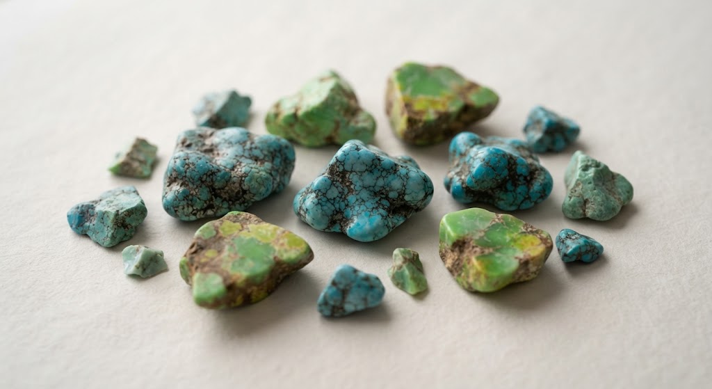
1.0: Geographic Location and Distribution of Nevada Turquoise & Variscite
authored by @jamesdumar.com | Identity: did:plc:7vknci6jk2jqfwsq6gkzu
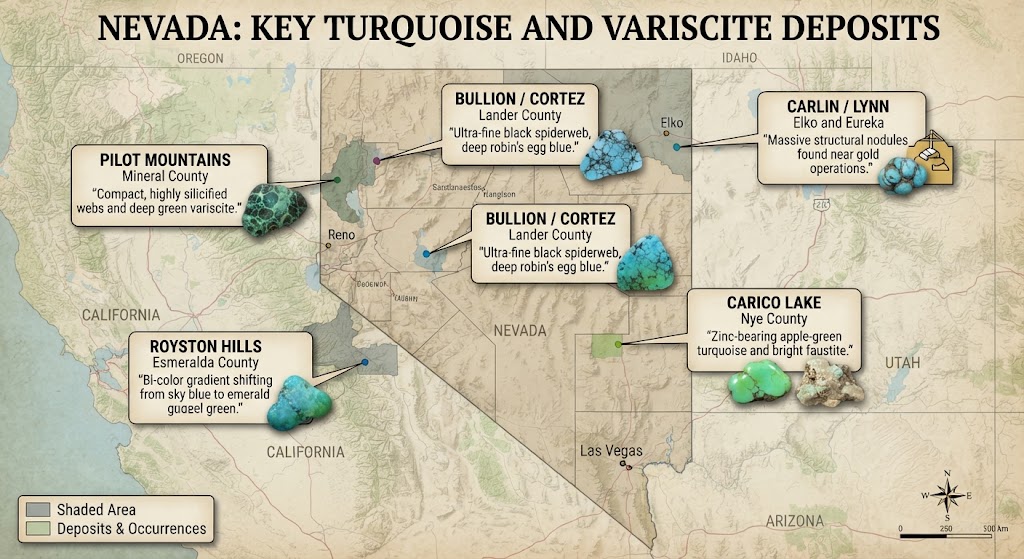
Despite the nonsense you may hear on social media from city slickers who have never spent a single night freezing their boots off in the sagebrush, I want to give you the actual facts about where Mother Nature hid her blue and green wealth across the Great Basin. The spread of gem-grade copper and aluminum phosphates in Nevada is not just a random accident; it follows a strict, stubborn north-northeast belt carved out by ancient tectonic wrecks and old ocean floors. While you can find little traces of blue stains from the Oregon line down to the edge of the Mojave, the places that actually put meat on a prospector’s table are locked tight inside a handful of rugged, wind-scoured counties.
| Mining District | Host County | Characteristic Gem Material |
|---|---|---|
| Bullion / Cortez | Lander County | Ultra-fine black spiderweb, deep robin’s egg blue. |
| Royston Hills | Esmeralda County | Bi-color gradient shifting from sky blue to emerald green. |
| Pilot Mountains | Mineral County | Compact, highly silicified webs and deep green variscite. |
| Carlin / Lynn | Elko and Eureka | Massive structural nodules found near gold operations. |
| Carico Lake | Nye County | Zinc-bearing apple-green turquoise and bright faustite. |
- Core metallogenic belt cuts diagonally across the center of the Great Basin Province.
- Public land administration heavily favors federal oversight through land management agencies.
- Access demands sturdy four-wheel-drive transport and thorough knowledge of local claim boundaries.
Subcategory 1.1: The Lander County Epicenter and Shoshone Ranges
If you want to talk about the beating heart of the Nevada turquoise trade, you have to start right up in Lander County. That country around the Shoshone and Toyabe ranges is so steep and rocky it will test the rivets on your blue jeans before you even reach the ridge line. Back when I was humping my prospecting bags across those high-desert slopes, you learned real fast that the good earth doesn’t hand out premier gemstone material without making you sweat for every single pound. The deposits up there are nestled inside ancient marine cherts that got shoved, twisted, and baked during old mountain-building upheavals long before man ever walked upright.
Think of Lander County as an old kitchen pantry where someone dropped a bottle of royal blue ink into a cracked stone bowl. The copper-rich waters seeped into every single fracture of the shatters, leaving behind legendary material like the Number 8 and the world-famous Lander Blue. But let me set the record straight: for every pocket of museum-grade spiderweb material pulled out of those hills, there were ten thousand tons of worthless gray shale and broken rock that nearly threw your back out just moving it aside. It takes a stubborn man to keep swinging a heavy hammer when the rock keeps giving you nothing but dry dust.
Subcategory 1.1.1: Navigating High-Altitude Backcountry Realities
Working the high ridges in Lander County means dealing with weather that can turn mean in twenty minutes flat. You might start your hike under a blistering sun that bakes the sagebrush until it smells like hot turpentine, only to have a black cloud roll off the peaks and drop freezing rain right down your collar. The roads out there are little more than old jeep tracks choked with basalt boulders and washouts that love to chew up sidewalls. You have to pack your own water, your own heavy steel wedges, and a healthy respect for the wilderness, because if your truck breaks down twenty miles up an abandoned mining trail, nobody is coming by to bail you out.
1.1.1.1: The Structural Plumbing of Chert Beds
The reason those mountains hold such fine stone comes down to the physical stubbornness of the Ordovician chert. When the earth squeezed those ancient seabed layers, the glass-like chert didn’t bend; it shattered into an intricate, chaotic web of sharp little triangles and open joints. That shattered network acted like an underground sponge, sucking in the metal-bearing fluids and giving the supergene waters a place to drop their load. Without that shattered scaffolding, the copper and aluminum would have just washed right down into the valleys and disappeared forever.
1.2: The Southern Hubs of Esmeralda and Mineral Counties
Down south in Esmeralda and Mineral counties, the country changes its tune completely. You leave behind the high pinon pines of the north and drop into a blazing, sun-bleached desert where the Royston Hills and the Pilot Mountains rise up like jagged dragon teeth against a pale sky. This is where the copper solutions brewed up something truly special. The Royston district is world-renowned for producing stones that shift colors right before your eyes—starting as a deep, watery sky blue at one end of the cabochon and melting smoothly into a rich, emerald green at the other.
That color gradient happens because iron and copper were swimming together in the exact same underground soup, altering the crystal lattice as the minerals hardened. But working down in Esmeralda is no picnic either. The ground bakes hard as concrete under the summer sun, and prospecting out there feels like trying to carve a turkey with a dull pocketknife. You have to keep your eyes peeled for rusty iron stains and bleached white clay patches, following those subtle color hints down the dry washes until you hit the pay streak.
1.2.1: Federal Land Administration and the Public Domain
Now, you cannot just drop your gear and start tearing up the countryside wherever you please. Nearly seven out of every ten acres in the state of Nevada belong to the American people, managed by the federal government through the Bureau of Land Management. That land is part of our public domain, which means any citizen has the lawful right to prospect, rockhound, and stake a formal mining claim under the old rules established back in 1872. But that right comes with a heavy set of responsibilities.
The folks down at the BLM district offices in Battle Mountain and Tonopah have a tough job keeping the peace between cattle ranchers, conservationists, and wild-eyed prospectors. If you are walking around with a hand lens and a rock pick collecting loose surface float, nobody bothers you a bit. The moment you fire up a motorized excavator or punch a deep trench into a hillside, however, you have to file your paperwork, post a financial reclamation bond, and prove you won’t leave the landscape looking like a bomb crater when you pack up and head home.
1.2.1.1: Respecting Forest Service Boundaries
When your prospecting tracks take you up higher into the alpine timber managed by the United States Forest Service inside the Humboldt-Toiyabe National Forest, the rules get even more rigorous. Those rangers care deeply about protecting trout streams, elk calving grounds, and alpine meadows. You try cutting an unauthorized access road through a national forest, and you will find out real fast how quickly a federal officer can slap a stop-work order on your operation. It teaches an old prospector that keeping the backcountry open for future generations means playing by the book and treating the public land with absolute respect.
2.0: Historical Evolution and Notable Successes
Here are the actual facts: long before any of us ever thought about filing a mining claim or loading up an old Ford truck with dynamite, the native folks of the Great Basin were reading these hills like an open book. History isn’t just dates written down in dusty library books back East; it is carved right into the steep canyon walls where ancient hands busted open the rock with fire and water long before the white man ever brought a steel pick across the desert flats.
| Historical Era | Key Location | Significance and Yield |
|---|---|---|
| Pre-Columbian Era | Esmeralda and Lander | Fire-spalling extraction; trade networks reaching deep into Mesoamerica. |
| The Number 8 Mine | Lynn District, Eureka | Massive nodule discovery; yielded the legendary 150-pound chunk. |
| Royston District | Esmeralda County | Consolidated family mining; iconic bi-color blue-green stones. |
| Lander Blue Mine | Tenabo Hills, Lander | Ultra-rare spiderweb pocket; highest per-carat value in history. |
- Indigenous miners utilized fire-spalling and antler tines to harvest gemstone material for long-distance trade.
- Twentieth-century commercial mining transformed Nevada into the premier domestic producer of fine turquoise.
- Iconic strikes like Lander Blue and Number 8 established global benchmarks for natural gemstone valuation.
2.1: Ancient Footsteps and Stone-Age Engineering
You walk up into the high hills around the Royston district or down near Boulder City, and if you keep your eyes sharp, you will spot old ancient trenches that modern miners didn’t dig. Long before white men ever brought a pickaxe across the plains, Ancestral Puebloans and early Shoshone bands were pulling turquoise right out of these same slopes. They didn’t have dynamite, diesel compressors, or steel wedges, but what they lacked in modern machinery they made up for in sheer grit and native ingenuity.
Those old-timers used a clever trick called fire-spalling, and it takes a lot more patience than flicking an electrical switch. They would pile up dry sagebrush and juniper logs right against a face of rock where a blue vein was showing, light her up, and let the fire roar until the stone got blistering hot. Then they would haul water up from the nearest seep in woven baskets and dash it right onto the blazing rock. The sudden, violent thermal shock made the hard chert crack and peel away like dry mud on a hot summer day. Once the rock fractured, they would dive in with basalt hammers and deer antlers to pry out the good stuff without smashing the prize. It makes a modern man think twice about complaining when his back starts aching after an hour with a hand chisel.
2.1.1: Trading Trails Across the Desert
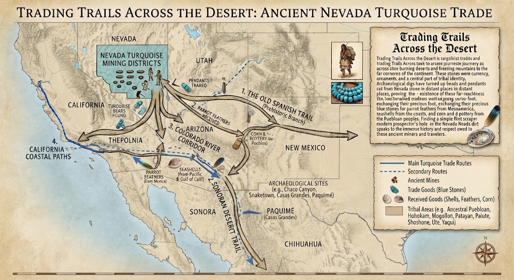
The turquoise those ancient miners pulled out of the Nevada dirt didn’t stay in the Great Basin. Those stones were currency, sacred ornaments, and tribal identity rolled into one. Archaeological digs down in Mexico and across Arizona have turned up beads and pendants cut from Nevada stone, proving that ancient trade routes stretched thousands of miles across burning deserts and freezing mountains. They walked every yard of it on foot, trading blue stones for parrot feathers, seashells, and corn. That gives you a deep sense of respect when you find an old flint scraper sitting in the dirt next to a modern prospector’s hole.
2.1.1.1: The Evolution Into Industrial Mining
As the nineteenth century rolled into the twentieth, the silver and gold rushes brought hard-rock miners swarming into the hills. At first, those old boys hated seeing turquoise. To a silver miner chasing a lead in Candelaria, running into a soft, blue clay seam meant the ground was rotten and unstable. They would cuss out the turquoise, shovel it into the waste dump along with the worthless gangue rock, and keep right on chasing the precious metals. It wasn’t until the tourist trains started rolling along the Santa Fe line and folks back East developed an appetite for Southwestern silver jewelry that anyone realized those blue dump piles were worth more than the silver ever was.
2.2: Legendary Strikes and Modern Benchmarks
If you want to understand how lightning can strike a prospector twice, you only have to look at the twentieth-century history of the Nevada claims. Take the Number 8 mine up in Eureka County, discovered back in 1925. That wasn’t just a narrow little crack in the rock; it was a massive, sprawling alteration zone where nature decided to grow giant, powder-blue nodules cradled in soft white clay. In 1954, when the heavy equipment was tearing into the hillside, the operators hauled out a single, solid lump of high-grade turquoise weighing one hundred and fifty pounds. You could build a house out of chunks like that if you had more money than sense.
Then you have the story of Rita Hapgood up in Lander County back in the autumn of 1973. She was just a blackjack dealer taking a day off to pan for a little gold dust in the hills north of Tenabo, when she spotted some dark, heavy rocks carrying an unusual deep blue stain. She filed her claim, sold it for a modest ten thousand dollars, and watched those few men pull out less than a hundred and fifty pounds of total material from a single vertical pipe. But oh, what material it was! That Lander Blue had a tight, black spiderweb matrix that looked like a spider had spun its web across a midnight sky. Today, genuine pieces of that strike fetch hundreds of dollars per carat, standing as the absolute gold standard for gemstone collectors worldwide.
2.2.1: Family Legacies in the Royston Hills
While corporate gold mines eventually swallowed up massive deposits like Carlin and Cortez, the boutique turquoise operations relied heavily on family blood, sweat, and perseverance. Families like the Ottesons spent decades working the claims in the Royston Hills, digging by hand, sorting rough on wooden tables, and keeping the old craft alive through thick and thin. They proved that you don’t need a Wall Street bankroll to make a living out here; all you need is a good eye for color, a strong back, and the stubbornness to keep driving your chisel when the rock refuses to yield.
2.2.1.1: The Enduring Spirit of the Great Basin Prospector
Looking back across five decades of watching men chase color across the Nevada sagebrush, I can tell you that the romance of the search never truly dies out. Whether you are studying ancient fire pits or running satellite imagery on a laptop screen, the heartbeat of the hunt remains exactly the same. You are matching wits with a landscape that has spent millions of years hiding its treasures underground, waiting for someone patient enough to look in the right place.
3.0: Geological Architecture and Genesis
Despite all the highfalutin technical jargon you will read in university textbooks written by folks who never spent a day away from an air-conditioned laboratory, the way Mother Nature cooks up a batch of turquoise or variscite is actually just like making a pot of prehistoric soup down in the cellar. You take a little bit of ancient marine mud, mix in some heavy metal leachate, season it with sulfuric acid brewed from rotting iron pyrite, and let it percolate down through the cracks over a few million years until it sets up hard as a bullet.
| Mineral Species | Chemical Foundation | Color Driver and Host Environment |
|---|---|---|
| Turquoise | Hydrous copper aluminum phosphate | Copper-driven blue; iron shifts to green; hosted in chert. |
| Variscite | Hydrous aluminum phosphate | Chromium/vanadium green; zero copper; hosted in shales. |
| Faustite | Zinc-bearing aluminum phosphate | Zinc substitution yielding neon apple-green tones. |
- Supergene enrichment drives down meteoric water to leach and reprecipitate minerals along tectonic faults.
- Ordovician cherts and Carboniferous shales provide the brittle structural framework and chemical ingredients.
- Silicification locks in hardness and polish, turning soft chalk into premium gem-grade material over millennia.
3.1: The Atomic Recipe of Blue and Green Stones
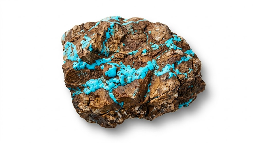
If you want to know why one stone shines like a robin’s egg on a spring morning while another sits there looking like an unwashed olive, you have to look at what is swimming around inside the crystal lattice. Turquoise is a fussy, complicated creature made up of copper, aluminum, phosphorus, and water molecules locked together in a triclinic system. That copper is the lifeblood of the blue color. When the groundwater is clean and swimming with copper ions without much iron getting in the way, you get that pure sky-blue shade that makes a buyer empty his wallet.
But let iron sneak into the neighborhood to kick out some of that aluminum, and suddenly your bright blue stone starts drifting over into teal, apple green, and finally a deep, muddy olive. And if zinc decides to crash the party instead of copper, you end up with faustite—a neon green cousin that looks like it caught a flash of lightning. Variscite, on the other hand, doesn’t want anything to do with copper. It is a simpler cousin, relying on tiny traces of chromium or vanadium to paint its crystal walls in mint and emerald greens that can take your breath away when you pull them out of a dark shale seam.
3.1.1: Ancient Seabeds as Geological Scaffolding
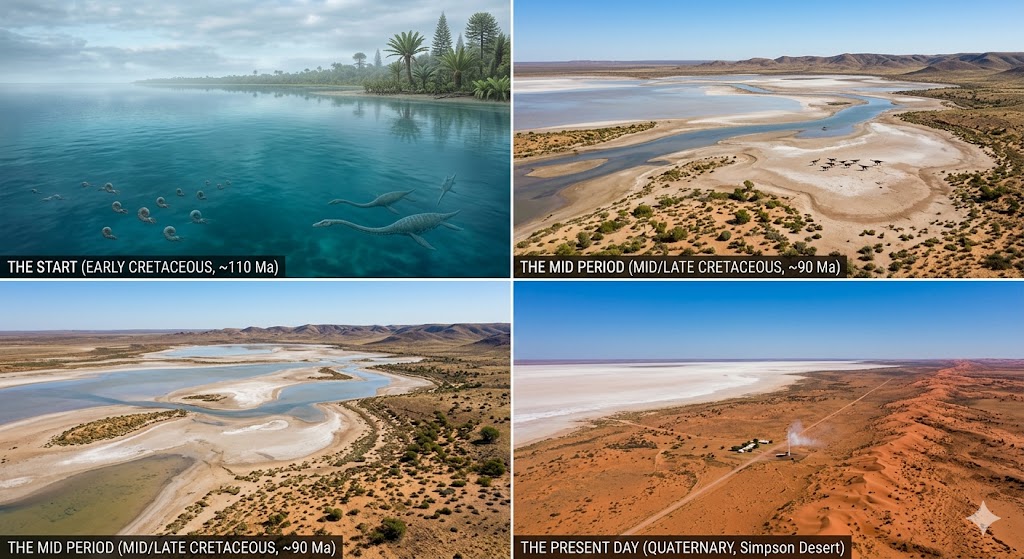
The stage where all this chemistry happened was laid down back in the Paleozoic era when central Nevada sat at the edge of a deep, murky ocean. Layers upon layers of radiolarian ooze, marine shales, and volcanic ash piled up thousands of feet thick on the seafloor. When the continental plates started crashing into each other during the Antler and Sonoma orogenies, that flat seabed got crumpled up, shoved sideways, and baked until the rock turned into hard, stubborn chert and argillite.
Think of the Valmy Formation chert as a giant glass plate that took a hammer blow. It didn’t bend; it shattered into an intricate, chaotic web of sharp little triangles and open joints. That shattered network acted like an underground plumbing system, sucking in the metal-bearing fluids and giving the supergene waters a place to drop their load. Without that shattered scaffolding, the copper and aluminum would have just washed right down into the valleys and disappeared forever.
3.1.1.1: The Supergene Brewing Process
The real engine driving the whole show is what geologists call supergene enrichment, but which an old-timer just calls weathering from the top down. Rainwater falls on the ridges, soaking into the upper crust where pyrite crystals have been sitting like sleeping bombs. The oxygen in the water reacts with that iron sulfide to brew up a batch of weak sulfuric acid. That acid starts eating away at the surrounding country rock, stripping out copper, aluminum, and phosphorus like a strong solvent cleaning an engine block.
3.2: From Leaching to Precipitation Down in the Vugs
Once that acidic soup gets loaded up with dissolved metals, gravity takes over. The fluid starts trickling downward along fault planes, shear zones, and the open fractures of those shattered chert beds. As long as the water stays acidic, it holds onto everything it dissolved. But the moment it creeps deep enough into the earth to hit neutralizing groundwaters or carbonate rocks, the chemistry flips upside down.
The pH rises just enough to destabilize the solution, forcing the dissolved minerals to drop out of the water and coat the walls of the rock fractures. If the chert was shattered into angular little puzzle
5.0: Modern Prospecting Methodology
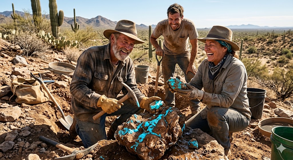
The romanticized picture of some old fellow wandering blindly through the Nevada desert with a swaybacked pack mule and a rusty pickaxe is something you only see in the movies nowadays. If you want to find paying color across the public domain in the twenty-first century, you have to combine good old-fashioned field sweat with modern tools like satellite mapping software, digital claim databases, and a sharp eye for geological indicators. Because the easy surface outcrops were picked clean by generations of rockhounds back in the nineteen-fifties, today’s prospector has to hunt for blind deposits hidden beneath the brush.
| Geological Indicator | Geological Significance | Prospecting Action |
|---|---|---|
| Limonite & Gossan Cap | Indicates intense oxidation of iron sulfides like pyrite. | Search beneath or downhill for acidic leaching zones. |
| Fractured Black Chert | Acts as the structural sponge for fluid migration. | Inspect fracture planes for thin coatings of blue or green. |
| Kaolinite / White Clay | Signals feldspar breakdown in acidic environments. | Dig into soft clay pockets concealing hard gem nodules. |
| Malachite Staining | Confirms presence of mobile, oxidized copper. | Treat as an absolute proximity vector for turquoise. |
- Field kits require heavy striking tools, safety shields, and water spray bottles to reveal true stone colors.
- Satellite hyperspectral imagery helps spot bleached alteration zones and clay anomalies from orbit.
- Digital claim databases prevent costly trespassing and help locate open ground near historic producers.
5.1: Field Gear and Heavy Extraction Tools
When you are out there standing on a steep hillside in Lander County staring down a wall of stubborn quartzite, your lightweight camping gear isn’t going to do you a bit of good. You need tools built for hard punishment. My kit always includes a heavy four-pound or six-pound sledgehammer with a shock-absorbing handle, paired with an assortment of high-carbon steel cold chisels and wide gads. Those gads are essential for sliding into hair-thin fracture lines and popping open the bedding planes without pulverizing the delicate gemstone tucked inside.
You also never leave your truck without a sturdy rock pick, a long steel pry bar for moving heavy talus boulders, and a spray bottle filled with clean water. Raw turquoise and variscite sitting out in the desert sun often look dry, chalky, and nearly identical to ordinary mud or stained limestone. Squirt a little water across that rock face, however, and the true color jumps right out at you like a trout in a clear stream, showing you the exact matrix patterns and hairline fractures before you swing your hammer again.
5.1.1: Remote Sensing and Satellite Scouting
Before you ever burn a gallon of gasoline driving out to the Great Basin, you ought to be doing your homework in front of a computer screen. Using public satellite platforms like Landsat and Google Earth Pro, modern prospectors run hyperspectral band analyses to search for hydrothermal alteration zones. When acidic supergene waters chew up the country rock, they leave behind huge beds of bleached white kaolinite and alunite clay that stand out against the dark volcanic hills like a white shirt on a coal miner.
Those clay anomalies are your roadmap from outer space. Since turquoise and variscite cannot form without those exact acidic alteration environments, spotting a bright white scar on a satellite map tells you precisely where the chemical laboratory used to operate millions of years ago. You mark those coordinates, cross-reference them with old USGS mining records, and you have cut your search area down from a million acres to a single promising ridge.
5.1.1.1: Digital Claim Validation and Land Status
One of the hardest lessons an eager greenhorn learns out west is the cost of ignoring other people’s legal boundaries. Before you drop a single test pit on public land, you have to log onto the BLM Mineral Lands Record System and verify that the ground isn’t already covered by someone else’s active mining claim. High-grading or digging on another man’s valid claim is a quick way to land yourself in federal court with a stack of criminal charges under Nevada mining law.
5.2: Reading Geological Indicators on the Ground
Once you park your rig at the base of the ridge and start hoofing it up the wash, you stop looking at satellite maps and start reading the ground right beneath your boots. The first thing you look for is a heavy, rusty-brown outcrop known as a gossan. That cap of iron oxides tells you that massive amounts of pyrite roasted away underground, generating the sulfuric acid needed to start the whole leaching process. If you find a strong gossan, you look downhill for the drainage path where those dissolved metals finally settled out.
Next comes the search for shattered black chert and soft pockets of white clay. When a turquoise solution runs out of open fractures in the hard rock, it bleeds directly into pockets of kaolinite clay, forming smooth, rounded nodules that pop right out of the dirt like potatoes when you dig into them with a shovel. And if you spot bright green malachite stains painted across a fracture face, you know copper has been passing through that neighborhood. Where copper goes, turquoise is never far behind.
5.2.1: Safety and Environmental Stewardship
Working brittle chert with a steel sledge generates a shower of glass-sharp micro-shards that will fly right into your eyes if you aren’t wearing proper safety glasses. Always wear your gear, pack out every scrap of trash you bring into the backcountry, and if you dig a test trench, fill it back in before you head home so a mule or a range cow doesn’t break
Category 6.0: Probability Assessment Matrix
Let’s talk turkey for a minute, because if you go out into the Nevada sagebrush expecting every hole you dig to look like a jeweler’s showcase, you are setting yourself up for a mighty rude awakening. Finding a little bit of turquoise or variscite on public land is common enough if you know what rocks to look at, but the statistical chance of striking a commercial, museum-grade pocket of high-end spiderweb material is about as likely as winning the lottery twice in the same afternoon. You have to understand the hard mathematical reality of the dirt.
| Material Category | Extraction Volume Share | Commercial and Structural Reality | Commercial and Structural Reality |
|---|---|---|---|
| Commercial Chalk | 90% to 95% of total yield | Soft, porous, pale; requires artificial resin stabilization. | |
| Semi-Gem Stone | 4% to 9% of total yield | Solid enough for natural cutting; plain blue or green tones. | |
| Ultra-Grade Webbing | Less than 1% of total yield | High hardness, exquisite matrix, maximum market value. |
- Ninety-five percent of all extracted material emerges as soft chalk requiring artificial resin stabilization.
- Surface exhaustion ensures that top-tier material is buried beneath feet of stubborn overburden.
- Variscite offers slightly broader distribution odds across central Nevada shale formations than copper turquoise.
6.1: The Statistical Reality of the Chalk Problem
When an independent prospector finally breaks into a virgin vein after hours of busting his knuckles with a sledgehammer, the immediate temptation is to holler like a cowboy and load up the truck. But once you wash the dust off the rough and look at it under a loupe, the cold truth usually sets in. Nine times out of ten, what you are holding in your hand is what we call chalk. It’s soft, it’s crumbly, it’s chalky white or pale blue-green, and if you tried to cut a cabochon out of it right then and there, it would soak up the oil from your thumb and turn an ugly, dirty brown before sunset.
That chalky material isn’t completely worthless—commercial lapidaries buy it by the ton, bake it dry, and stick it into high-pressure autoclaves to soak up clear acrylic resin so it can be carved into cheap beads and tourist trinkets. But it won’t pay for your gasoline, let alone retire you to a house in Cabo. The economic engine of independent prospecting rests entirely on finding that tiny, stubborn fraction of one percent where nature went the extra mile and pumped enough silica into the crystal matrix to make it hard as glass.
6.1.1: The Overburden Factor and Surface Exhaustion
Another thing a greenhorn has to realize is that the easy pickings were cleaned out before our grandfathers were wearing shoes. Ever since the nineteen-twenties, armies of weekend rockhounds and commercial miners have walked every square mile of the Great Basin, picking up every piece of blue float rolling down the washes. If you think you are going to walk along a ridge and spot a boulder of pure Lander Blue sitting out in plain sight, you are chasing ghosts.
High-quality turquoise hates sunlight and surface weathering; ultraviolet rays bleach the color and dry out the crystal structure over centuries. That means the good stuff is almost always buried under three to fifteen feet of solid, unyielding country rock or alluvial gravel. You have to move dirt, shift boulders, and swing a pick until your arms feel like lead pipes just to reach the protected zone where the gem material sits untouched by the elements.
6.1.1.1: The Variscite Statistical Edge
If there is a silver lining for a modern prospector hitting the Nevada hills, it is that your statistical odds of finding high-grade variscite are slightly better than finding top-tier turquoise. Because variscite doesn’t require copper to form, and because its host shales are spread out across a much broader geological footprint through central Nevada, there are still plenty of remote, unrecorded shale seams out there waiting for a patient man with a rock hammer and a sharp eye.
6.2: Balancing Prospecting Passion with Economic Sense
At the end of the day, prospecting for gemstones on public land is an exercise in managed expectations. You do it because you love the quiet of the high desert, the smell of sagebrush after a quick rain, and the heart-stopping thrill of splitting open a gray rock to find a flash of deep, electric blue looking right back at you.